BG8.3 | From Long-Term Flux Observation and Ecosystem Research Networks to Individual Applications - Benefits to Science and Society
From Long-Term Flux Observation and Ecosystem Research Networks to Individual Applications - Benefits to Science and Society
Co-sponsored by ICOS
Convener: Andreas Ibrom | Co-conveners: George Burba, Alexander Graf, Natalia Kowalska, Kaido Soosaar, Marilyn Roland, Dario Papale
Orals
| Mon, 04 May, 10:45–12:30 (CEST)
 
Room 2.23
Posters on site
| Attendance Mon, 04 May, 14:00–15:45 (CEST) | Display Mon, 04 May, 14:00–18:00
 
Hall X1
Orals |
Mon, 10:45
Mon, 14:00
This session is merged from the sessions "Long-Term Flux Observation and Ecosystem Research Networks - Benefits for Science and Society" and "Using Flux Measurement for Immediate Societal Benefits".

The first part of the session provides:

• A discussion platform to exchange the state-of-the-art and novel developments in such long-term research networks
• Recognition of the multiple values of these networks for science and society
• Mutual interaction between users, networks organisers, and stations

Specific topics are :

1. Characteristics and challenges of long-term measurements in research networks: e.g., adaptation to change (scientific progress, technology change, and scopes), data harmonisation, new methods and procedures, attribution of ecosystem changes to external versus internal factors.
2. Scientific results specific to the analysis of long-term data: among others, e.g,. temporal scales of change: climate change, trends and variability, role of network products for synthesis studies
3. Synergy from collaboration with other scientific communities (e.g. collocation with other networks, campaign studies, scientific studies)
4. Sustainability and purposes to society – dialogue with stakeholders and users, participation

The second part focuses on using flux measurements for immediate societal benefits:

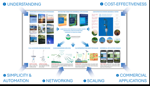
• Most of the ongoing GHG measurements are used for important discoveries achieved through process-level academic studies, and for long-term climate and ecosystem modeling. Most of the water measurements at the GHG flux sites are used for applications of computing and interpreting ecosystem-level GHG exchange.

• Such measurements use ultra-high-resolution methodology and state-of-the-art hardware vastly superior to typical monitoring-grade methods and equipment deployed outside academia for a wide range of non-academic decision-making applications, from gas leaks to drought or heat wave detections. However, despite providing exceptional ways to measure GHG emissions and ET, direct flux measurements are very rarely utilized outside academia.

This part of the session, organized through research-industry collaborations, presents new ideas and existing examples of how to better utilize direct flux measurements for immediate societal benefits.

Orals: Mon, 4 May, 10:45–12:30 | Room 2.23

The oral presentations are given in a hybrid format supported by a Zoom meeting featuring on-site and virtual presentations. The button to access the Zoom meeting appears just before the time block starts.
Chairpersons: Marilyn Roland, Kaido Soosaar, Alexander Graf
10:45–10:50
10:50–11:00
|
EGU26-20887
|
Highlight
|
On-site presentation
Simone Sabbatini, Adriana Mariotti, Eleonora Canfora, Carlo Trotta, Luca Di Fiore, Gilberto Pastorello, David Joseph Moore, Margaret Torn, Kimberly Ann Novick, Trevor Keenan, Peter Isaac, Cacilia Ewenz, and Dario Papale

The FLUXNET2015 release of flux tower data represents a milestone in the global landscape of eddy covariance based monitoring of CO2 and other greenhouse gas (GHG) land-atmosphere exchanges. For the first time more than 200 stations across the globe joined forces towards a standardized product, facilitated by a centralized processing and a unique software (OneFLUX, Pastorello et al. 2020). This paved the way for a deeper understanding of ecosystem responses to climate change and other stressors, as well as for improved performances of satellite products via better calibration and validation data, together with better upscaling and mapping efforts. However, the complexity of such an effort made it impossible to replicate it in a short timeframe for a fully comprehensive new release. Still in 2015, the “birth” of the ICOS ERIC, the European monitoring network of GHG land-atmosphere exchanges, represented another game-changer. The collaboration between ICOS and its American and Australian counterparts, AmeriFlux and OzFlux, led to the launch in December 2025 of the FLUXNET Data System Initiative, characterized by a new, continuously updated approach. With the present contribution we intend to describe the main features of the new system and the benefits we expect it will deliver to the flux, satellite and modeling communities and other stakeholders. By decentralizing the processing and the communication with the smaller regional networks to the three data hubs (ICOS, AmeriFlux and OZFlux), we were able to: (i) extend the data coverage in time and space, including historically under-represented areas and biomes; (ii) building a new API-based tool for the accessibility of the datasets, the FLUXNET Shuttle (Papale et al., 2020), allowing a quasi-continuous update of the datasets, thus suppressing the need for “static” new releases in the future; (iii) increasing the efficiency of the OneFLUX software, in particular in the case of long gaps and for ecosystems in special conditions. This effort constituted also an occasion to define a strategy for handling the legacy of long-term timeseries, and an opportunity for the study and construction of new solutions for peculiar cases, like the synthetic ustar threshold for urban flux towers.

How to cite: Sabbatini, S., Mariotti, A., Canfora, E., Trotta, C., Di Fiore, L., Pastorello, G., Moore, D. J., Torn, M., Novick, K. A., Keenan, T., Isaac, P., Ewenz, C., and Papale, D.: The FLUXNET (r)evolution: a coordinated, global effort for longer, more representative and more accessible flux tower datasets, EGU General Assembly 2026, Vienna, Austria, 3–8 May 2026, EGU26-20887, https://doi.org/10.5194/egusphere-egu26-20887, 2026.

11:00–11:10
|
EGU26-241
|
On-site presentation
Ivan Vorobevskii, Rico Kronenberg, Thomas Grünwald, and Matthias Mauder

Robust climate-impact and (eco)hydrological modelling as well as reproducible research practices rely on (micro)meteorological forcing data that are both physically consistent and stable across dataset versions — conditions that are often difficult to meet within long-term micrometeorological networks. Continuous reprocessing of raw measurements, as implemented in ICOS and FLUXNET, can unintentionally reshape subdaily time series and thereby alter simulations of water and energy balance components. In our research, we identified two major post-processing error sources: dataset versioning and gap-filling. To evaluate how these transformations propagate into process-based modelling, we used the ICOS DE-Tha old-spruce forest site in Saxony (Germany) as a representative case study and applied the subdaily, physically based 1D ecohydrological model BROOK90 to perturbed forcing datasets.

Successive ICOS dataset versions introduced substantial corrections to air temperature, solar radiation, precipitation, wind speed, and vapor pressure, which in turn noticeably altered simulated interception, transpiration, and soil evaporation. Standard ICOS gap-filling procedures (MDS and ERA-I) were also found to generate implausible values, particularly where outputs from different algorithms occurred in close succession, producing artificial spikes such as 10 °C temperature jumps within a 30-minute interval. Artificial gap-filling experiments using ERA-I demonstrated that uncertainties in modeled water and energy balance components increase systematically with both the proportion (1-50%) and the block-length (30 min - 30 days) of substituted subdaily meteorological data. Precipitation and solar radiation replacements induced the strongest single-variate deviations, and multivariate gap-filling resulted in substantially larger uncertainties than single-variable substitutions—approaching 25% overestimation for latent heat (LE) and more than 40% underestimation for sensible heat (H) at 50% substitution using 30-minute blocks. Evapotranspiration partitioning revealed consistent bias patterns under multivariate substitutions, including reduced transpiration and strong overestimation of interception and soil evaporation. Although BROOK90 remained numerically stable across all tested perturbation scenarios, inconsistencies in subdaily forcing propagated into physically implausible process representations.

Importantly, similar inconsistencies and artifacts have been found across many ICOS and FLUXNET sites worldwide, indicating that these issues are systemic rather than site-specific. Our findings highlight that reproducibility and reliability in long-term flux-network modelling depends critically on transparent dataset versioning, rigorous anomaly detection, and harmonized multivariate gap-filling practices. Strengthening these components will enhance the scientific value of flux networks by ensuring that impact-based ecosystem modelling is grounded in trustworthy subdaily forcing data.

How to cite: Vorobevskii, I., Kronenberg, R., Grünwald, T., and Mauder, M.: Assessing  micro-meteorological flux network data quality: implications for water and energy flux modelling, EGU General Assembly 2026, Vienna, Austria, 3–8 May 2026, EGU26-241, https://doi.org/10.5194/egusphere-egu26-241, 2026.

11:10–11:20
|
EGU26-10984
|
On-site presentation
Gregor Feig, Ryan Blanchard, Abri De Buys, Siphesihle Faltein, Warren Joubert, Helga Knoetze, Amukelani Maluleke, Jeremy Moonsamy, Nolusindiso Ndara, Sylvester Selala, Felix Skhosana, Kathleen Smart, and Michele Toucher

South Africa is developing a network of flux observations to support studies on coupled ecological and social systems. Currently, eight flux measurement sites are operated by the South African Environmental Observation Network (SAEON) and the Council for Scientific and Industrial Research (CSIR). Data from these observations are openly available online in near real-time, following standardised quality control and FAIR data principles. Each of the flux observations forms part of a landscape-scale research infrastructure (RI) co-designed with researchers, land managers and policy stakeholders to ensure long-term relevance for both science and decision making. Landscape RI sites include suites of standard continuous meteorological, hydrological, and repeated manual measurements covering biodiversity, productivity, ecosystem condition, and ecosystem service provision and use. These landscapes encompass a diverse suite of biomes across South Africa, including arid shrubland, subtropical savanna, tropical grassland, high-altitude mesic grassland, Afromontane forests, and fynbos, with a range of land-use types and tenure systems represented. These long-term research infrastructure platforms have been utilised in numerous national and international projects supporting scientific development and informed societal decision-making. This presentation will focus on infrastructure co-design and development with broad stakeholder groups and showcase results highlighting activities in the RI, outputs, lessons learned, and future priorities

How to cite: Feig, G., Blanchard, R., De Buys, A., Faltein, S., Joubert, W., Knoetze, H., Maluleke, A., Moonsamy, J., Ndara, N., Selala, S., Skhosana, F., Smart, K., and Toucher, M.: Long-term flux observation network development in South Africa – national platforms to support environmental research and evidence-based decision making , EGU General Assembly 2026, Vienna, Austria, 3–8 May 2026, EGU26-10984, https://doi.org/10.5194/egusphere-egu26-10984, 2026.

11:20–11:30
|
EGU26-17755
|
On-site presentation
Michelle Garneau, Paul del Giorgio, Scott Davidson, Sara Knox, Oliver Sonnentag, Vincent Maire, Alexandre Roy, Evelyne Thiffault, Marc-André Bourgault, Martina Schlaipfer, Léonie Perrier, David Trejo Cancino, Michaela Ladeira de Melo, Laurent Lessard, Jean-Benoît Leblond Chouinard, and Zoran Nesic

Funded by the Quebec Government, the CARBONIQUE  project seeks to better understand the carbon storage capacity of the main wetland types in southern Quebec - open and treed peatlands, coastal freshwater marshes and swamps. By quantifying their contributions, the project highlights the role these ecosystems can play within a broader portfolio of approaches for addressing climate change. This focus is particularly important in southern Quebec, where wetlands are under the greatest anthropogenic pressure and where informed management decisions can have the largest impact.

To  achieve this, the project will quantify both the carbon and water cycles at paired natural (intact) and disturbed sites for each wetland type (alongside one restored marsh site) and examine how these two cycles interact. Atmospheric carbon exchange will be measured using eddy covariance flux towers and integrated with measurements of above and belowground carbon stocks, lateral carbon fluxes and hydrological processes. As of spring 2026, six sites have been equipped with an eddy covariance flux tower. Three additional sites will be instrumented in summer 2026, expanding the network and enabling robust comparisons across all wetland types and disturbance regimes.

The project will provide crucial predictive understanding to inform policy, guide wetland conservation and management, and support the design of effective climate change mitigation strategies across multiple levels of government.

How to cite: Garneau, M., del Giorgio, P., Davidson, S., Knox, S., Sonnentag, O., Maire, V., Roy, A., Thiffault, E., Bourgault, M.-A., Schlaipfer, M., Perrier, L., Trejo Cancino, D., Ladeira de Melo, M., Lessard, L., Leblond Chouinard, J.-B., and Nesic, Z.: The CARBONIQUE project: Carbon cycling in Quebec's wetlands, EGU General Assembly 2026, Vienna, Austria, 3–8 May 2026, EGU26-17755, https://doi.org/10.5194/egusphere-egu26-17755, 2026.

11:30–11:40
|
EGU26-6292
|
On-site presentation
Anders Lindroth, Johannes Edvardsson, Jutta Holst, Maj-Lena Linderson, and Meelis Mölder

In ICOS site Norunda, Sweden, CO2 fluxes and meteorology have been measured since 1994 in a mixed pine/spruce forest. Tree cores were collected in 2020 and ring widths were used to estimate annual above and below ground increment using allometric functions. Weather data during 1995 to 2022 showed increases in air temperature (0.044 K/yr), short-wave radiation (0.44 W/m2/yr) and vapour pressure deficit (0.092 kPa/yr) while precipitation did not show any trend. The earlier start of the growing season caused the season length to increase with 0.86 days/yr. Net ecosystem exchange showed a weakening (more positive) trend while no trends were detected in GPP and RECO. Tree growth showed a decreasing trend with time but no correlation with GPP and RECO. Carbon use efficiency defined as tree growth divided by GPP showed a decreasing trend with time.

How to cite: Lindroth, A., Edvardsson, J., Holst, J., Linderson, M.-L., and Mölder, M.: Trends in Long-Term CO₂ Fluxes in Relation to Weather and Tree Growth in a Mixed Hemiboreal Forest, EGU General Assembly 2026, Vienna, Austria, 3–8 May 2026, EGU26-6292, https://doi.org/10.5194/egusphere-egu26-6292, 2026.

11:40–11:50
|
EGU26-17104
|
Virtual presentation
Geza Toth

Direct measurements and satellite-derived estimates of Net Ecosystem Exchange (NEE) provide a robust, ecosystem-scale view of land–atmosphere CO₂ dynamics, yet they are rarely connected to product-level carbon accounting frameworks used in policy and markets. This contribution presents a practical, ISO-aligned methodology for integrating NEE into Life Cycle Assessment (LCA) and Product Carbon Footprints, bridging land-based flux measurements with product-based MRV.

The approach replaces generic cultivation-stage emission factors with site-specific NEE data, while preserving full compliance with ISO 14040/44 and ISO 14067. A core boundary-based decision rule ensures carbon mass balance and prevents double counting by explicitly accounting for the fate of harvested biomass carbon. The method is demonstrated across multiple real-world case studies, including oil palm, livestock feed systems, and tobacco production, using both satellite-based and multi-year averaged NEE data.

Results show that integrating NEE substantially improves the climate relevance of product footprints, enabling year-on-year tracking of land management performance and revealing carbon footprint reductions of 19–47% relative to conventional LCAs. Beyond accounting, the framework enables direct translation of flux measurements into decision-relevant indicators for insetting, land management optimization, and supply-chain MRV. The work illustrates how flux science can move from research contexts into scalable, auditable applications with clear societal and market benefits. 

How to cite: Toth, G.: From Fluxes to Footprints: Integrating Net Ecosystem Exchange into Product Carbon MRV, EGU General Assembly 2026, Vienna, Austria, 3–8 May 2026, EGU26-17104, https://doi.org/10.5194/egusphere-egu26-17104, 2026.

11:50–12:00
|
EGU26-72
|
ECS
|
On-site presentation
Shirin Hosseinipour and Ali Mehdinia

  Mitigating climate change and managing land sustainably depends on understanding and quantifying carbon dynamics in ecosystems. Here we present a framework to integrate advanced direct carbon flux measurement techniques (e.g., eddy covariance and chamber methods) with spatially explicit ecosystem service modeling through the invest (Integrated Valuation of Ecosystem Services and Tradeoffs) framework, which can be applied across a diversity of ecosystems (e.g., coastal wetlands, mangroves, seagrass, forests, grasslands) to increase the spatial and temporal precision and meaningfulness of ecosystem carbon accounting and valuation.

The methodology presented makes use of high-resolution land use and land cover (LULC) data and field-measured carbon pool parameters (i.e., aboveground biomass, belowground biomass, soil organic carbon, litter pools), as well as direct flux data from eddy covariance systems, in two ways: as direct empirical inputs quantifying net ecosystem exchange (NEE) that are site- and time-specific rates of carbon accumulation or emission, and as necessary standards for comprehensive model calibration and validation. The twofold utility of direct flux data reduces errors associated with prevalent generalized carbon stock assumptions and allows full representation of variability in carbon flux under different land-management and disturbance regimes.

We apply this integrated framework to simulate carbon stock dynamics and annual carbon sequestration rates under various land-use change and ecological restoration scenarios. The spatially explicit outputs include detailed ecosystem maps of carbon storage, flux rates, and net carbon budgets that can inform targeted conservation and sustainable use strategies. Merging these adaptations to biophysical outputs with economic valuation problems that incorporate current pricing schemes in carbon markets and the social cost of carbon will allow stakeholders and policy makers to efficiently evaluate trade-offs among ecosystem services, economic returns, and climate benefits.

Our approach is scalable and adaptable, allowing decision-making to occur over a range of biological contexts from dynamic coastal ecosystems that are subject to anthropogenic disturbance to more stable terrestrial biomes. This combination of research will allow for climate change initiatives to be implemented with vigorous due assessment of data-driven evaluation tools that will further the advancement of the dual goals of carbon neutrality and resilience of existing ecosystems to degrading events. These systems allow for direct measurements of relevant fluxes within complex models that engage ecosystem services and make them viable, filling important gaps in the understanding of empirical data relevant to ecology, biogeochemical modeling, and realistically set policy guidelines.

Keywords: Carbon Flux, Coastal Ecosystem, Eddy Covariance, Ecosystem Service Modeling, Climate Mitigation, Carbon Market Valuation.


How to cite: Hosseinipour, S. and Mehdinia, A.: Integration of Direct Carbon Flux Measurements with Ecosystem Service Modeling: A Scalable Approach for Coastal and Terrestrial Systems, EGU General Assembly 2026, Vienna, Austria, 3–8 May 2026, EGU26-72, https://doi.org/10.5194/egusphere-egu26-72, 2026.

12:00–12:10
|
EGU26-330
|
ECS
|
On-site presentation
Pramit Kumar Deb Burman, Gs Bhat, Yogesh Tiwari, Ross Morrison, Suraj Reddy Rodda, Sandipan Mukherjee, Vk Dadhwal, Andrew Turner, Pulakesh Das, Geetika Agarwal, Dipankar Sarma, Praveen Mutyala, Nirmali Gogoi, Palingamoorthy Gnanamoorthy, Sreenath Paleri, and Devansh Desai

Hosting the largest population in the world and one of the major growing economies, the greenhouse gas emissions from India remain significant. This is also largely contributed to by the vast agricultural tracts in this country, which occupy more than half of its landmass. However, India is committed to the Paris Climate Accord, and the biodiverse forests, mangroves, and grasslands in this region occupy almost 40% of the landmass, which stores potentially a large amount of carbon. In the context of a changing climate, it is also crucial to understand the ecohydrology of these ecosystems, as it is intricately linked to their carbon cycle. The coupling between these two is a crucial factor in ensuring sustainable development, as land and water remain two resources constrained by various developmental and mitigation activities. However, the magnitude and spatiotemporal variabilities of carbon, water, and energy exchanges between terrestrial ecosystems and the atmosphere are not well understood in India, primarily due to a lack of coordinated efforts in measuring these using Eddy Covariance (EC) techniques. This lacuna has hindered the development of remote sensing-based biophysical products and ecosystem models, leading to uncertainties in the national, regional, and global carbon budgets. In this study, the EC flux observations in India, across the dominant land use and land cover types in 12 locations, are systematically reviewed using a standard methodology. The assessment shows that cropland absorbs the maximum carbon during the Indian monsoon, although this is not generally true for all agro-climatic regions. Some forests, croplands, and mangroves function as well-watered ecosystems, while others oscillate between well-watered and water-stressed conditions, depending on the temperature and moisture availability. Mangroves sequester a large amount of carbon; however, their ability to sequester carbon is restricted by the salinity of the surrounding basin. Water-limited ecosystems demonstrate the highest water-use efficiency (WUE); irrigated croplands exhibit the lowest. Indian forests, which are mainly tropical and subtropical, register a lower WUE than the temperate and boreal forests. The global and regional flux networks, such as FLUXNET, AmeriFlux, AsiaFlux, ICOS, and OzFlux, have greatly improved our understanding of terrestrial ecosystem functioning and ecosystem-atmosphere exchanges, whereas our data review and systematic analysis are the first of their kind in India. These will be useful to the research community, planners, and policymakers alike, aiding in improved decision-making and the just allocation of resources to benefit all stakeholders.

How to cite: Deb Burman, P. K., Bhat, G., Tiwari, Y., Morrison, R., Rodda, S. R., Mukherjee, S., Dadhwal, V., Turner, A., Das, P., Agarwal, G., Sarma, D., Mutyala, P., Gogoi, N., Gnanamoorthy, P., Paleri, S., and Desai, D.: Biosphere-Atmosphere Exchanges of Carbon, Water, and Energy in India: Synthesis from Eddy Covariance Measurements for Enabling Socioeconomic Benefits, EGU General Assembly 2026, Vienna, Austria, 3–8 May 2026, EGU26-330, https://doi.org/10.5194/egusphere-egu26-330, 2026.

12:10–12:20
|
EGU26-8987
|
ECS
|
On-site presentation
Wei Hu, Jason Blake Cohen, Yanqiu Liu, Bo Zheng, and Kai Qin

Accurate quantification of greenhouse gas (GHG) emissions from coal mining activities is crucial for developing effective mitigation strategies and achieving carbon neutrality goals. This study presents a multi-month (starting August 2025) experimental campaign conducted in a prominent coal mining cluster. We deployed a high-precision ground-based observation tower (70m a.g.l) to monitor continuous atmospheric concentrations and calculate fluxes of CH4, CO2 at DaBuTou station (36.07˚N, 112.88˚E, hereafter DBT). The DBT station is located in Zhangzi, Changzhi, Shanxi Province, and has several coal mines within a 10-km radius in all directions of the observation site. An LI-7700 Open-Path CH4 Gas Analyzer (LI-COR, Inc.) was mounted at a 65.2 m height on the tower, along with an Integrated CO2/H2O Open-Path Gas Analyzer and 3D Sonic Anemometer (IRGASON, Campbell Scientific, Inc.). To bridge the gap between observed concentrations and source strengths, the Weather Research and Forecasting (WRF) model coupled with the Stochastic Time-Inverted Lagrangian Transport (STILT) model was employed. The WRF-STILT framework was used to generate high-resolution footprints, characterizing the sensitive source areas contributing to the tower flux and concentration measurements.

Preliminary results reveal significant diurnal variations in methane footprints, driven by complex terrain and fluctuating operational intensities within the coal-mining cluster. Height selection fundamentally dictates the spatial representativeness of specific mining activities within the cluster, providing a critical benchmark for optimizing emission estimate model’s parameters to ensure that flux measurements are strategically weighted toward key industrial emitters. We note some interesting conclusions: first that it is possible to separate some of the various coal mine sources from each other using a sufficiently long dataset; and second that observational uncertainty spans both concentration and wind observations in tandem, meaning that simple approaches for emissions estimation are insufficient; and finally that a very small number of days have a substantial difference in terms of emissions from the other days, requiring that observations be conducted very long-term before annual or other types of climatological conditions can be established.

In conclusion, this research provides a robust framework for utilizing direct CH4 flux measurements to characterize fugitive emissions in coal-mining clusters. Our findings establish a verifiable 'ground-truth' framework that not only refines regional emission inventories but also serves as a critical diagnostic tool for industrial stakeholders and regulatory agencies to implement verifiable GHG reduction pathways and advance toward net-zero climate goals.

How to cite: Hu, W., Cohen, J. B., Liu, Y., Zheng, B., and Qin, K.: Coupling Long-Term Ground-Based Flux Measurements with a Lagrangian Transport Model to Quantify and Attribute Emissions in a Coal Mining Cluster, EGU General Assembly 2026, Vienna, Austria, 3–8 May 2026, EGU26-8987, https://doi.org/10.5194/egusphere-egu26-8987, 2026.

12:20–12:30
|
EGU26-9210
|
ECS
|
On-site presentation
Emma Lopez, Jean-Christophe Domec, Denis Loustau, Christophe Chipeaux, Cyriane Garrigou, Jean-Marie Côme, and Virginie Moreaux

In the context of the environmental crisis and steadily increasing energy demand, diversifying energy sources has driven the deployment of renewable energies, particularly photovoltaics. Photovoltaic energy is generally considered a low-carbon alternative to fossil fuels due to the absence of direct emissions during electricity generation. However, beyond these debated considerations, gaps remain in post-installation assessments of surface areas. Photovoltaic panels alter the surrounding microclimate, and these changes can affect soil and vegetation, which are major controls on how carbon is released to or absorbed from the atmosphere. To our knowledge, no study in temperate regions has yet quantified the CO₂ fluxes directly resulting from post-installation land surface changes.

Between 2022 and 2024, we measured CO₂ fluxes at two solar parks in France. The first, located in northwest France (Normandy), covers 19 ha of former industrial land with partly impermeable soils and sparse vegetation. The second, in southwest France (Gironde), spans 127 ha on a former maritime pine plantation within a predominantly forested landscape and is characterized by wet heathland soils.

In 2024, both sites exhibited neutral to positive annual NEE balances (carbon sources), with values of 20 ± 9 gC/m² in Normandy and 184 ± 55 gC/m² in Gironde. Although biomass was greater at the Gironde site, annual GPP in 2024 was 654 ± 27 gC/m² compared with 842 ± 53 gC/m² in Normandy, where the growing season was significantly longer, partly explaining the differences in annual NEE. Total respiration was 838 ± 16 gC/m² in Gironde and 862 ± 56 gC/m², in Normandy. Differences between sites in the sensitivity of vegetation cover and its ecophysiological processes to climate and soil conditions, as well as in their efficiency in using light and water, partly explained the overall patterns and seasonal partitioning of carbon fluxes. Vegetation and land management also played an important role in regulating emissions. In Gironde, practices such as mowing and grazing contributed to the low GPP. These results highlight the key role of the vegetation cover in regulating carbon fluxes and its potential to mitigate emissions under suitable conditions and management in photovoltaic ecosystems.

How to cite: Lopez, E., Domec, J.-C., Loustau, D., Chipeaux, C., Garrigou, C., Côme, J.-M., and Moreaux, V.: Quantifying CO₂ emissions from ground-mounted solar parks in temperate climates and the potential mitigating role of surface vegetation, EGU General Assembly 2026, Vienna, Austria, 3–8 May 2026, EGU26-9210, https://doi.org/10.5194/egusphere-egu26-9210, 2026.

Posters on site: Mon, 4 May, 14:00–15:45 | Hall X1

The posters scheduled for on-site presentation are only visible in the poster hall in Vienna. If authors uploaded their presentation files, these files are linked from the abstracts below.
Display time: Mon, 4 May, 14:00–18:00
Chairpersons: George Burba, Andreas Ibrom, Dario Papale
X1.111
|
EGU26-11934
Yusri Yusup, Andreas Rauber, Ehsan Jolous Jamshidi, Japareng Lalung, and Martin Weise

Flux measurements play a critical role in informing climate mitigation, ecosystem management, and land–atmosphere interaction studies. However, their broader societal impact is often limited by fragmented data management, insufficient metadata, and unclear version histories that hinder reproducibility, citation, and effective reuse. Here, we demonstrate how the DBRepo data repository system can be used to operationalize principles, dataset versioning, precise identification of arbitrary subsets, and citation practices for flux data, while maintaining alignment with established standards such as those used by FLUXNET. Using flux datasets deposited in DBRepo, we illustrate how explicit versioning and persistent identifiers enable users to track updates, assess the impact of data revisions on analytical outcomes, and ensure that derived results remain interpretable and citable over time. This is particularly relevant for educational and applied contexts, where students, researchers, and non-academic stakeholders require clarity on which data version underpins a given conclusion. Mapping the data representations to established ontologies and FLUXNET conventions, to capture their semantics and units of measurements, further enhances interoperability and lowers the barrier for integrating locally managed flux datasets into broader analysis workflows. By framing versioned, FAIR flux data as a learning and decision-support resource rather than static research output, this work highlights how data infrastructure can directly enhance data literacy, analytical skills, and trust in flux-based evidence. Such practices are essential for translating flux observations into robust, actionable insights with immediate societal benefits.

How to cite: Yusup, Y., Rauber, A., Jamshidi, E. J., Lalung, J., and Weise, M.: Advanced Research Data Management to Enhance Reuse and Societal Impact of Flux Data, EGU General Assembly 2026, Vienna, Austria, 3–8 May 2026, EGU26-11934, https://doi.org/10.5194/egusphere-egu26-11934, 2026.

X1.112
|
EGU26-20962
Adriana Mariotti, Carlo Trotta, Simone Sabbatini, Eleonora Canfora, and Dario Papale

Long-term observations of carbon, water, and energy exchanges, together with meteorological measurements, are essential for quantifying climate variability and change and for supporting ecosystem and climate model development. Eddy covariance networks provide unique multi-decadal datasets. However, their legacy data, historical observations collected prior to or during the evolution of standardized protocols, represent a critical resource. These datasets are frequently fragmented and may suffer from inconsistent formats and incomplete or missing metadata describing: how, when, and where data were collected, processed, and analyzed. Without systematic curation and harmonization, such data remain difficult to interpret, compare, and reuse. 

A metadata-driven approach was applied to long-term datasets from nineteen ICOS Network stations in order to integrate legacy eddy covariance data into standardized data infrastructures. These long-term datasets are released through the FLUXNET Data System, a continuously updated, open-access platform that provides harmonized flux and meteorological observations, complemented by comprehensive metadata. In this contribution, we focus on a representative subset of these datasets to examine key methodological and practical aspects that are critical for effective long-term data integration. We demonstrate how detailed and structured metadata enable the identification and resolution of inconsistencies arising from changes in instrumentation, sensor characteristics, spatial representativeness, and data processing methodologies, over multi-decadal periods.

A systematic metadata cross-walking procedure is used to document and reconcile historical site-specific changes, ensuring temporal continuity, data comparability, and transparency. This case study highlights the central role of metadata in bridging legacy datasets with contemporary standards, supporting FAIR data principles, and enabling the construction of interoperable long-term observational datasets. The proposed approach enhances data quality, interpretability, and reusability, thereby maximizing the scientific value of long-term eddy covariance observations for climate and ecosystem research.

How to cite: Mariotti, A., Trotta, C., Sabbatini, S., Canfora, E., and Papale, D.: Harmonizing Legacy Eddy Covariance Data within the ICOS and FLUXNET Networks: Methodological Insights from Long-Term Observations, EGU General Assembly 2026, Vienna, Austria, 3–8 May 2026, EGU26-20962, https://doi.org/10.5194/egusphere-egu26-20962, 2026.

X1.113
|
EGU26-67
George Burba

Continental-scale research infrastructures and flux networks, alongside smaller networks and individual sites, directly measure evaporative water loss, as well as heat, CO2, CH4, and other gas exchange between the surface and the atmosphere. Over four decades, such flux stations covered 2100+ stationary measurement points and various campaign sites.

Despite such major advantages as extremely high-resolution, real-time results, continuous and direct nature of flux measurements, their applications are only now and rather slowly entering fields beyond academia due to the perceived method complexity, actual complexity and cost of traditional instrumentation and site operation, lack of broad geographic data coverage, and absence of a comprehensive approach focused on direct flux measurements specifically tailored for bringing immediate societal benefits.

This presentation continues to address these challenges by simplifying explanations, offering detailed guides for practicing the method, presenting the latest lower-cost simple automated instrumentation and novel computing tools, facilitating peer-to-peer cross-sharing to increase data coverage and reduce station setup costs, and providing professional services for experiment design and execution.

One example of the most recent developments is the 2025 publication of three new plain-language guides/protocols on direct dMRV/aMRV/MMRV (Figure below). These aim to fundamentally change carbon markets by providing a direct, defensible, traceable, repeatable, real-time, evidence-based approach to quantify sequestration and emission in application beyond academia.

The ultimate goal of this presentation is to ignite discussions on utilizing flux measurements for practical decision-making applications to benefit society and to identify current needs, ideas, and examples for leveraging flux data in everyday decision contexts.


How to cite: Burba, G.: Latest Tools and Protocols for Using Direct Flux Measurement outside Academia, EGU General Assembly 2026, Vienna, Austria, 3–8 May 2026, EGU26-67, https://doi.org/10.5194/egusphere-egu26-67, 2026.

X1.114
|
EGU26-21220
Susanne Tautenhahn, Martin Jung, Jana Wäldchen, Ladislav Šigut, Sung Ching Lee, Markus Reichstein, Dario Papale, Jacob Nelson, Sophia Walther, Flavian Tschurr, Nina Buchmann, Jens Kattge, Florian Jansen, Jürgen Dengler, and Gabriele Midolo and the FloraFlux community

Understanding why ecosystems respond differently to environmental drivers, and how vegetation mediates land–atmosphere fluxes of matter and energy, remains a central challenge in ecosystem functioning research. Lacking information on biodiversity—spanning species composition, plant functional traits, bioindication, understory vegetation, and vegetation dynamics— may have prevented significant progress here. FloraFlux enables the collection of this complementary “biodiversity layer” to unlock new opportunities for interpreting and modelling ecosystem fluxes and functions across flux tower sites.

FloraFlux is a community-driven initiative to collect plant species occurrence data at eddy covariance flux sites worldwide. Integrated as a flux tower–specific project into the Flora Incognita app for automated plant identification, FloraFlux enables participants to document and share spatially and temporally explicit plant species occurrence information within tower footprints seamlessly with only a smartphone. Participation is simple and inclusive, requires no botanical expertise, and supports open data sharing within the flux tower community. 

Data processing pipelines linking FloraFlux observations to existing biodiversity and ecosystem research infrastructures are already in place, including: (1) pan-European bio-indication systems such as EIVE for local climate and soil conditions, (2) the European Disturbance Indicator Values for disturbance and management, and (3) the global plant trait data from the TRY Plant Trait Database.

The first FloraFlux field season in 2025 already yielded >1,500 plant observations from >30 flux tower sites in Europe. ~40 participants contributed data, and > 50 newsletter subscribers prove the feasibility and acceptance of this collaborative effort. A Shiny web application will provide a map and site-level summaries of plant traits and bio-indicators (QR code on poster).

We are starting to explore key questions, such as:

  • How can plant functional traits and bio-indicator values help us understand ecosystem functional properties and spatial variation in fluxes?

  • How do ecosystems with different biodiversity and local site conditions respond to environmental drivers such as drought, pests, or management interventions?

  • What is the role of understory and herb-layer vegetation in modulating flux variability?

  • How does functional diversity influence ecosystem resilience, for example in terms of recovery after drought or extreme events?

  • How can integrating species-level traits and bio-indicators complement or refine traditional plant functional type classifications?

First exploratory analyses show a strong relationship between maximum NEP and plant indicator values for soil nitrogen (R² = 0.45, rising to >0.9 when including further traits and bio-indicators) derived from species observations. These initial findings underscore the potential of FloraFlux to contribute the “missing biodiversity link” to long-term flux research and strengthen the scientific and societal value of networks such as ICOS or FLUXNET.

All flux tower teams worldwide are invited to the 2026 FloraFlux season. Join us with your smartphone at the poster for assistance. More participants and observations enhance our collective understanding of biodiversity’s role in ecosystem functioning.

Join FloraFlux and contribute to biodiversity–ecosystem functioning research effortlessly!

How to cite: Tautenhahn, S., Jung, M., Wäldchen, J., Šigut, L., Lee, S. C., Reichstein, M., Papale, D., Nelson, J., Walther, S., Tschurr, F., Buchmann, N., Kattge, J., Jansen, F., Dengler, J., and Midolo, G. and the FloraFlux community: FloraFlux: Automated plant identification for understanding ecosystem functioning across global flux tower sites, EGU General Assembly 2026, Vienna, Austria, 3–8 May 2026, EGU26-21220, https://doi.org/10.5194/egusphere-egu26-21220, 2026.

X1.115
|
EGU26-21377
Jean-Martial Cohard, Ossenatou Mamadou, Miriam Hounsinou, and Renaud Koukoui

CO2 fluxes observations and associated annual budgets are essential to understand the functioning of ecosystems and the sequestration capacities of continental areas. On a global scale, scarcity of carbon fluxes and stocks on the African continent has been identified by the carbon community as a source of uncertainty for climate models. At the local scale, ecosystem/atmosphere exchanges in terms of water and carbon are poorly documented in the equatorial belt, making it difficult to implement sustainable strategies for land use planning and agricultural systems, which are necessary for adaptation to global changes.

We present one of the largest CO2 measurement series for two tropical ecosystems in Benin, under a Sudanese climate: a light forest and an agricultural area. The series cover the period 2008-2024. Processing these data has revealed specificities in terms of qualification, selection, and gap-filling procedures. In particular, temperature models are inefficient for calculating respiration due to the low seasonal variability of daily temperatures. Ecophysiological parameters (dark respiration, quantum light efficiency, maximum CO2 assimilation rate) show more intense activity for the forest than for the agricultural area. The seasonality of phenology also contrasts between the two sites, with a rapid increase in Amax associated with leafing before the rainy season for the forest and a steady increase with the onset of the rainy season for the agricultural area.

These measurements, carried out as part of the AMMA-CATCH observatory, contribute to a regional dynamic led by the WAF-Net collective, which brings together scientist involved in measuring carbon and water flows in West Africa.

How to cite: Cohard, J.-M., Mamadou, O., Hounsinou, M., and Koukoui, R.: Phenological behavior of  a cultivated savannah and an open clear forest in a tropical humid climate in West Africa derived Eddycovariance fluxes., EGU General Assembly 2026, Vienna, Austria, 3–8 May 2026, EGU26-21377, https://doi.org/10.5194/egusphere-egu26-21377, 2026.

X1.116
|
EGU26-8239
Debora Regina Roberti, Alecsander Mergen, Richard Lobato, Eberton de Souza, Cristiano Maboni, Tamires Zimmer, Maria Eduarda Oliveira, and Rodrigo J. S. Jacques

Regenerative agriculture is recognized as a promising strategy for mitigating greenhouse gas emissions through the adoption of practices that improve soil quality and modulate biogeochemical cycles. Southern Brazil is characterized by a subtropical climate and intensive agricultural systems with a high potential for carbon sequestration. However, quantifying the effects of regenerative practices on CO₂ fluxes and defining reliable emission and uptake factors remain significant scientific challenges. This study presents multiyear time series of carbon dioxide (CO₂) fluxes and evapotranspiration (ET) obtained from eddy covariance flux towers installed in representative conventional and regenerative agricultural systems of the region, including wheat–soybean–maize succession, flooded rice cultivation, and cattle grazing on native grasslands of the Pampa biome. The regenerative practices evaluated included the introduction of cover crops during fallow periods, thereby eliminating bare-soil phases in the wheat–soybean–maize system. In rice systems, winter forage crops and summer rotation with soybean were implemented. In native grasslands, winter forage species were introduced without soil disturbance. The results consistently show that regenerative systems exhibit greater net CO₂ uptake across different agricultural years compared to conventional systems. Reducing fallow periods in the wheat–soybean–maize succession and introducing winter forages in native Pampa grasslands increased carbon uptake, making agroecosystems in southern Brazil important sinks of CO₂-eq. Flooded areas used for irrigated rice cultivation, although not becoming net CO₂-eq sinks with the introduction of soybean rotation or pasture, showed a substantial reduction in CO₂-eq emissions. Interannual analyses demonstrated that the magnitude of CO₂ and H₂O fluxes is strongly modulated by climatic variability, particularly differences in precipitation regimes, temperature, and crop cycle duration. These findings highlight the importance of continuous, long-term measurements to capture the uncertainty range associated with climate variability and agricultural management, thereby enabling the development of more robust and representative emission and uptake factors. Based on strong observational evidence, this study contributes to improving the scientific basis for assessing agroecosystem sustainability, supporting public policies, and advancing carbon certification mechanisms.

How to cite: Roberti, D. R., Mergen, A., Lobato, R., de Souza, E., Maboni, C., Zimmer, T., Oliveira, M. E., and Jacques, R. J. S.: Response of CO₂ and H₂O fluxes to the adoption of regenerative practices in Brazilian subtropical agroecosystems monitored by Eddy Covariance, EGU General Assembly 2026, Vienna, Austria, 3–8 May 2026, EGU26-8239, https://doi.org/10.5194/egusphere-egu26-8239, 2026.

X1.117
|
EGU26-9166
Xiaojun Dou, Guirui Yu, Zhi Chen, and Yucui Zhang

Ecosystem water use efficiency (WUE), defined as the amount of carbon sequestration per unit of water consumed, is significantly influenced by various factors, including elevated atmospheric CO2, changing climate, vegetation growth, nitrogen deposition, and so on. However, the response of the water and carbon coupled cycles to global change and the underlying comprehensive driving mechanisms of multiple factors remain unclear. Based on global 475 situ eddy covariance fluxes sites data released by FLUXNET, AmeriFLUX, ICOS, OzFlux and ChinaFLUX, and integrated with multiple satellite remote sensing products, we upscaled global ecosystem WUE from 1982 to 2021 by using an ensemble of 27 machine learning models. Importantly, our findings suggest, largely attributed to the increase in fractional vegetation coverage (FVC), that the rapid increase in global WUE after 2012, while CO2 fertilization effect is not significant. Notably, FVC enhances gross primary productivity (GPP) but also limits evapotranspiration (ET) to some extent. This asynchronous effect doesn’t lead to a proportional increase in water consumption costs as carbon sinks rise. This study systematically elucidates the mechanisms through which WUE responds to climate change, thereby providing a more accurate prediction of the future water-carbon coupling cycle.

How to cite: Dou, X., Yu, G., Chen, Z., and Zhang, Y.: Increase of fractional vegetation coverage enhancing rise of water use efficiency over globe from 1982 to 2021, EGU General Assembly 2026, Vienna, Austria, 3–8 May 2026, EGU26-9166, https://doi.org/10.5194/egusphere-egu26-9166, 2026.

X1.118
|
EGU26-6090
Qiufeng Wang, Zihan Tai, Jianxing Zhu, Yue Xi, Yanran Chen, Quanhong Lin, Chenxu Wang, and Guirui Yu

Atmospheric phosphorus (P) deposition has become a significant external P source for terrestrial and aquatic ecosystems, influencing functions such as productivity by altering P bioavailability. However, systematic quantification of atmospheric P deposition in China is still lacking. Based on data from the China Wet Deposition Observation Network (ChinaWD) from 2014 to 2022, we explored the wet deposition fluxes, spatiotemporal patterns, and influencing factors of various atmospheric P components. The annual average wet deposition fluxes of total P (TP), dissolved total P (DTP), and total particulate P (TPP) in China were 0.63 ± 0.44, 0.34 ± 0.19 and 0.29 ± 0.26 kg P ha − 1 yr − 1 , respectively, with total deposition amounts of 0.60, 0.33 and 0.28 Tg P yr − 1 . Over 9 years, TP deposition flux declined at a rate of approximately 0.085 ± 0.022 kg P ha − 1 yr − 1 per year, potentially reflecting the sustained efforts of China in forest fire prevention and air quality management. This is the first network‐based, long‐term quantification of wet P deposition patterns across China, laying a foundation for assessing its ecological impacts.

How to cite: Wang, Q., Tai, Z., Zhu, J., Xi, Y., Chen, Y., Lin, Q., Wang, C., and Yu, G.: Declining Atmospheric Phosphorus Wet Deposition in China, EGU General Assembly 2026, Vienna, Austria, 3–8 May 2026, EGU26-6090, https://doi.org/10.5194/egusphere-egu26-6090, 2026.

X1.119
|
EGU26-20225
|
ECS
Luca Di Fiore, Simone Sabbatini, Giacomo Nicolini, and Dario Papale

The Eddy Covariance (EC) technique has been widely used to quantify gas exchanges between ecosystems and the atmosphere. Recently, the application of this method in urban areas has gained attention within the scientific community, aiming to understand, measure, and track the gas exchanges in densely populated areas. Among all the EC-related parameters, friction velocity (u*) is commonly used to identify non-turbulent (and thus unreliable) fluxes, calculating a threshold for filtering the data. However, standard approaches to calculate the u* threshold in urban areas cannot be applied.

Taking advantage of the data available from the FLUXNET Data System, we developed a modelling approach to estimate the u* threshold in urban sites. A set of predictive variables related to site physical and meteorological characteristics, u* values, and distribution indices (kurtosis, skewness) were tested within a multiple linear regression on non-urban sites. The relation was then applied to urban sites, calculating “synthetic” u* threshold values.  

Preliminary results show that u* has the highest predictive capacity, while the other variables add only a relatively small contribution in improving the model accuracy. In addition, the choice of site-related physical characteristics should be carefully evaluated according to their different behaviour in urban and non-urban sites. Since it is not possible to retrieve reference u* threshold values for urban sites, model validation is implemented only for non-urban sites.

Although without performing a calibration directly on urban sites, the proposed modelling approach represents a precious refinement in estimating EC fluxes in urban areas, allowing to generate u* threshold values where not possible with standard approaches. Moreover, the new FLUXNET Data System launched in December 2025 ensures a robust model calibration, providing a larger dataset compared to the previous data release. 

How to cite: Di Fiore, L., Sabbatini, S., Nicolini, G., and Papale, D.: A modelling approach to estimate the friction velocity threshold for Eddy Covariance measurements in urban areas, EGU General Assembly 2026, Vienna, Austria, 3–8 May 2026, EGU26-20225, https://doi.org/10.5194/egusphere-egu26-20225, 2026.

X1.120
|
EGU26-9327
Terenzio Zenone, Gabriele Guidolotti, Theodore Endreny, Teresa Bertolini, Marco Ciolfi, Michele Mattioni, Emanuele Pallozzi, and Carlo Calfapietra

The rapid expansion of urban populations, coupled with growing epidemiological evidence that associates extreme temperature events with adverse health outcomes and elevated mortality rates underscores the critical role of Urban Green Areas (UGAs) in delivering ecosystem services that enhance human well-being. Among these services, the air temperature cooling potential (ΔT°C) driven by ecosystem evapotranspiration (ET) represents a key mechanism for mitigating heat-related health risks.

This study investigates the capacity of various Machine Learning (ML) algorithms to predict the ΔT°C of UGAs, thereby supporting thermal regulation through ET and highlighting their importance in sustainable urban planning and climate adaptation strategies. We used multiple years of experimental Eddy Covariance (EC) observations of the ET the to train and validate a series of ML algorithms with the objective to simulate the cooling effect of the urban vegetation. A preliminary analysis of predictor variables was conducted to identify and rank their importance using the mean absolute Shapley (Sh) values. Results indicate that incoming shortwave solar radiation (Rg) was the most influential predictor (Sh = 0.45), followed by vapor pressure deficit (VPD, Sh = 0.20), relative humidity (RH, Sh = 0.075), air temperature (AirT, Sh = 0.065), friction velocity (u*, Sh = 0.02), and wind speed (WS, Sh = 0.01). The application of ML algorithms revealed that Bootstrap Aggregation (Bagging) and Least-Squares Boosting (LSBoost) performed best, achieving R² values of 0.89 and 0.83, respectively, during the training phase compared to observed data. Other algorithms, including Neural Networks (NN), Gaussian Process Regression (GPR), and Support Vector Machines (SVM), showed also similar, but slightly lower r2 , with values ranging from 0.80 (NN) to 0.79 (SVM). Ten-fold cross-validation confirmed robust generalization, as model performance remained consistent regardless of the data subset used to compute R² between modeled and observed values. Further evaluation using Taylor diagrams showed that the average normalized standard deviation (σn) and Pearson correlation coefficient of the models were 0.89 (±0.02) and 0.90 (±0.02), respectively, closely matching the observed data.

During the testing phase we observed, as expected, a clear reduction of the ML performance compared to the training phase: however, over the three years of the testing phase, RG bagging and LSBOOST have confirmed their superiority, compared to the other algorithms, with an average r2 between observed and simulated data of 0.66 and 0.67 respectively. Discrepancies between predicted and observed ΔT°C during testing were most evident during midday hours, with an average overestimation of 0.31°C (±0.2).

Overall, the investigated UGAs demonstrated an average capacity to reduce ambient air temperature during summer by approximately 2°C to 4°C.


How to cite: Zenone, T., Guidolotti, G., Endreny, T., Bertolini, T., Ciolfi, M., Mattioni, M., Pallozzi, E., and Calfapietra, C.: Data-driven prediction of urban vegetation cooling effects using machine learning and field observations, EGU General Assembly 2026, Vienna, Austria, 3–8 May 2026, EGU26-9327, https://doi.org/10.5194/egusphere-egu26-9327, 2026.

X1.121
|
EGU26-10299
Marta Galvagno, Sofia Koliopoulos, Chiara Guarnieri, Gianluca Filippa, Francesco Avanzi, Daria Ferraris, Federico Tagliaferro, Denise Chabloz, Edoardo Cremonese, Stefano Ferraris, Martina Lodigiani, Andrea Mainetti, Maddalena Nicora, and Paolo Pogliotti

Accurate quantification of evapotranspiration (ET) is a key challenge for understanding land–atmosphere interactions and optimizing water use in agriculture. Under ongoing climate change, reliable estimates of actual ET are critical in mountain regions such as in the Alps, where changes in temperature, precipitation, and snow dynamics strongly influence water availability and ecosystem functioning. While distributed information on ET is commonly derived through models based on remote sensing, meteorological variables, and crop coefficients, this study highlights the added value of direct ET observations. Indeed, model-based approaches, while useful for large-scale estimates, often fail to capture the strong spatial variability associated with heterogeneous landscapes and the complex response of ET to climatic drivers. Direct ET measurements, obtained through eddy covariance, are more reliable under stress conditions because they capture actual increases in ET during drought, driven by elevated atmospheric demand and sustained water supply from deep soil reservoirs. These mechanisms are commonly underrepresented by models due to simplifications in plant, soil, and hydraulic parameterizations.

Direct observations of actual ET are therefore essential for improving irrigation water requirement (IWR) assessments and supporting water management in agriculture. During 2025, within the Agile Arvier project (Next Generation EU), we implemented a regional network for direct ET measurements across the Aosta Valley region (north-western Italian Alps). Seven LI-710 evapotranspiration sensors (LI-COR) were installed across representative agricultural systems in the area. To further strengthen the observational network, these measurements have been integrated with long-term ET datasets from two ICOS-associated sites in the region (IT-Tor, IT-TrF), providing decadal-scale context, and with three additional LI-710 already present in the same territory. The final network totalizes twelve monitoring sites, including a vineyard, an apple orchard, six meadows and pastures, a European larch forest, an abandoned pasture, a wetland, and a high-altitude rocky environment, distributed along an altitudinal gradient from approximately 500 to 3100 m a.s.l. 

Results will include site-specific comparison between observed ET and estimates derived from regional IWR datasets, to refine irrigation requirement estimates based on observations. This comparison is expected to improve the reliability of irrigation planning tools and to support the Regional Agricultural Department in developing more efficient and adaptive water management strategies. Finally, the release of an online, open-access ET database will be presented, allowing to researchers, land owners, sector experts, and policymakers to access and download data, thereby contributing to transparent, evidence-based decision-making.

How to cite: Galvagno, M., Koliopoulos, S., Guarnieri, C., Filippa, G., Avanzi, F., Ferraris, D., Tagliaferro, F., Chabloz, D., Cremonese, E., Ferraris, S., Lodigiani, M., Mainetti, A., Nicora, M., and Pogliotti, P.: A regional evapotranspiration network for climate-resilient water management in mountain agro-ecosystems, EGU General Assembly 2026, Vienna, Austria, 3–8 May 2026, EGU26-10299, https://doi.org/10.5194/egusphere-egu26-10299, 2026.

X1.122
|
EGU26-2333
Daniel Beverly, Colin Campbell, Doug Cobos, Gaylon Campbell, and Meetpal Kukal

Evapotranspiration (ET) is the largest terrestrial water loss, accounting for 60% of precipitation and driving the regional and global water cycle. Land-use modifications, agricultural practices, and atmospheric warming can intensify ET demand, thereby presenting novel societal challenges and necessitating policies to conserve, monitor, and penalize overconsumption of freshwater. Unfortunately, the spatially and temporally aligned ET data products needed for operational policy practices, including precision agriculture and municipal water conservation efforts, are generally inaccessible due to the high costs of infrastructure and instruments, as well as the level of expertise required to operate these systems. Thus, practitioners are often limited to coarse spatially interpolated ET products, reference ET estimates, or alternative proxies to generate protocols for water-use applications.

Here, we introduce a new direct ET measurement sensor, the ATMOS 51 Variance Bowen Ratio (VBR) Direct ET Sensor, that leverages the Variance Bowen Ratio and energy-balance closure methods. This technology employs high-frequency temperature and specific humidity measurements to compute the Bowen ratio and ET from measured and modeled energy fluxes within the sensor footprint. The VBR technique, in general, and the implementation in the ATMOS 51 specifically, provides a compact design that allows for quick deployment, minutes compared to days, owing to the minimal infrastructure requirements. Moreover, its low power requirements make it ideal for field logging and seamless integration into cloud-based installations. Thus, providing a user-friendly experience and reducing the barrier to applying ET measurements to operational irrigation and water management decisions.

In 2025, we conducted extensive intercomparisons of the ATMOS 51 VBR Direct ET Sensor against field-standard measurements, namely eddy covariance towers and weighing lysimeters. The intercomparisons spanned numerous agroecological systems (e.g., potatoes, beets, barley, pasture, deciduous hardwood forest, desert shrubland) to characterize the best sensor application and practices.

Across the spectrum of agroecological systems, the ATMOS 51-measured ET closely matched the eddy covariance-derived ET fluxes, with a root-mean-square error (RMSE) among half-hourly measurements ranging from 0.02 to 0.07 mm. As expected, the ET measured by ATMOS 51 was 6-10% higher than that from the eddy covariance, attributed to the differences between the open- and closed-energy-balance approaches. Due to the reliance on energy-closure-based methods, the Variance Bowen Ratio method and ATMOS 51 perform best in systems with moderate-to-high ET rates and homogeneous footprints. More xeric locations, which exhibit higher sensible heat fluxes, will likely require more deliberate constraints on the energy balance terms, including soil heat flux, to optimize ET estimates.  

How to cite: Beverly, D., Campbell, C., Cobos, D., Campbell, G., and Kukal, M.: Expanding direct evapotranspiration (ET) measurements with accessible and low-cost Variance Bowen Ratio instruments, EGU General Assembly 2026, Vienna, Austria, 3–8 May 2026, EGU26-2333, https://doi.org/10.5194/egusphere-egu26-2333, 2026.

Please check your login data.